
Space-based technology and human rights
Space policy 16 February 2020The fact that human rights are under attack at global scale, is indeed, a fact. In the European Union and internationally, minorities, communities, asylum seekers and migrants – people – are under attack because “different”. Different from religion, culture and traditions to which European people are used to, and that are contributing to discrimination and fear, stimulating a wrong narrative of the EU. The fact that technology can monitor human rights violations, is less than a fact. Or it is, but it wasn’t until beginning of 2000. Technology, especially space-based technology and its data were exclusivity of the governments but only in the late ‘90s the privatisation of the market allowed end users to buy them from private companies.
It is in this framework that spaceborne imagery enter the cycle for the protection of human rights globally. International organizations started making use of them to bridge the gap between the lack of resources, the need to tell the truth, and the need to protect people by tracking and monitoring their communities and displacement; or assessing earth disturbance.
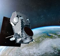
Remote sensing is the sensing of the earth’s surface from space. Remote sensing data are processed and then analysed by specific services providers and therefore readable by the specific end user. These technologies make it possible not only to monitor the weather forecasts, but to have access also to remote spaces in the world that are not accessible due to environment disasters, lack of communication technologies, wars and human rights violations.
Human right abuses are any different from Europe to Africa and there is no excuse to not make use of technology to safeguard them. But it is a fact that major displacements or earth disturbance have also been proved to happen in the African region, where space-based technologies have proven to be powerful tools to monitor and assess during the years, the extent of the abuses. Many are the examples to mention, over the years, “analysts have found visual evidence for escalating Boko Haram attacks in north-east Nigeria, North Korean labour camps, forced relocations in the Democratic Republic of Congo and have monitored the growing crisis in Darfur, western Sudan”.
Satellite imagery has the ability also to solve legal dispute over territories and borders. The first satellite imagery as evidence was brought to the International Court of Justice in 1986, over a dispute between Mali and Burkina Faso; the Court “held that maps are not title of territoriality until both parties assent to it”. A following case, in Namibia v. Botswana, a “boundary dispute was sought to be settled by satellite imagery, but the Court relied on it minimally”.
Since many international organisations make use of satellite imagery as a tool to complement the assessment of human rights violations, what is the concern regarding the admissibility of satellite imagery as a reliable evidence in Court? What are the limitations?
As satellite imageries data are processed by experts and in a second step sent to the lawmen, there should be a process of understanding of the use of these technologies by these actors. To facilitate international human rights proceedings, it is imperative that a proper mechanism or standard is established so that satellite imagery can be regarded in court as substantive evidence. There are different factors that influence the “mistrust” of such technology: its relative novelty and the fact that the data is digital in nature and therefore more easily manipulated; whether satellite imagery can be referred sufficient legal recognition as to have the necessary requirements of proof under international law; finally, additional concerns deal with the possible violation of the right of privacy of those captured in the data.
The European Court of Human Rights, as a European stakeholder, has not dealt directly with the admissibility of satellite imagery. However, “in the case of Moghaddas v. Turkey an asylum seeker submitted a satellite picture to support his claims. Now, it must be noted that the Court has indirectly referred to the problems of reliability of this particular type of evidence”. Another case, “Sufi and Elmi v. the United Kingdom, which originated in two applications (nos. 8319/07 and 11449/07) by two Somali nationals who alleged that if returned to Somalia they would be at real risk of ill-treatment”, the Court referred that it was possible that the UN figure could have had a great margin of errors as the estimates were based on satellite imageries.
Referring to the European Court of Human Rights, it is believed that “the Court will increasingly need to be alive to technological advances, allowing for the use, for example, of satellite imagery”.
The European Court of Justice (ECJ), instead, in the case “European Commission v. United Kingdom”, the UK challenged the reliability of EO information regarding the growth acceleration of algae. The ECJ, by its side, rejected the proof, since an isolated capture of image alone would not reveal the real expansion of that algae. However, admitted the considered EO data as evidence.
More and more satellites are now making their appearance into the space, of smaller dimensions, to have a real time monitoring of the Earth, to have more regular images of the earth to use also as clear evidences to defend human rights violations.
References:
https://www.aaas.org/news/satellite-imagery-international-human-rights-litigation
https://www.pri.org/stories/2012-10-12/eus-top-5-human-rights-issues
https://www.amnestyusa.org/pdfs/RemoteSensingAsEvidencePaper.pdf